


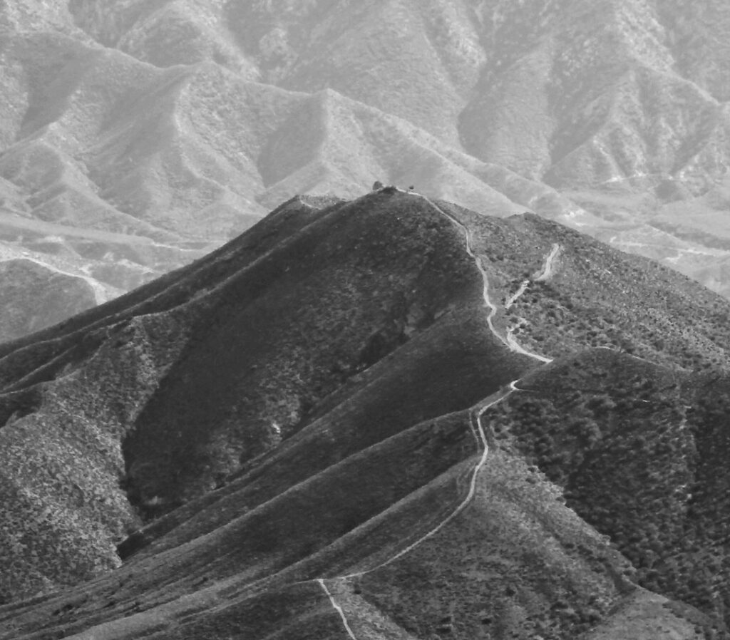
Parker Mountain
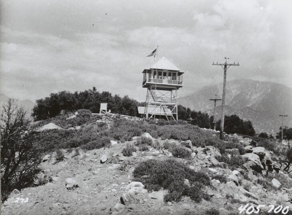
Parker Mountain Lookout Agency: Los Angeles County Forestry Department (Now LA County Fire Department)Dates: 1934-1960sTower: NETT20’- Non-battered, enclosed timber tower, […]
Parker Mountain Lookout Agency: Los Angeles County Forestry Department (Now LA County Fire Department)Dates: 1934-1960sTower: NETT20’- Non-battered, enclosed timber tower, […]
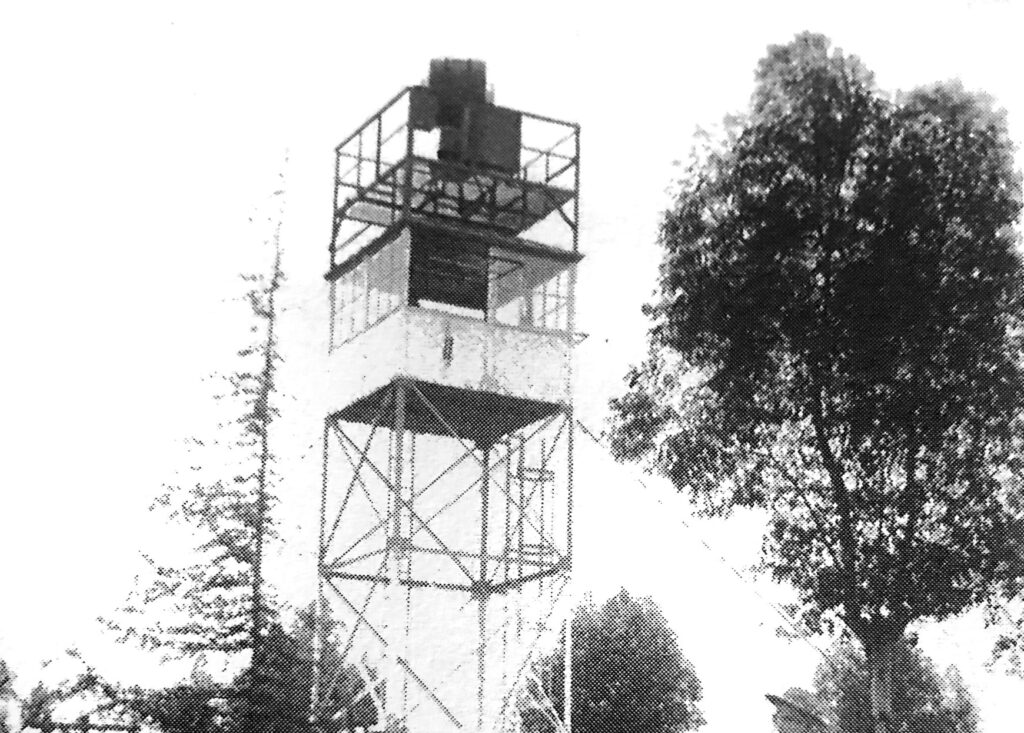
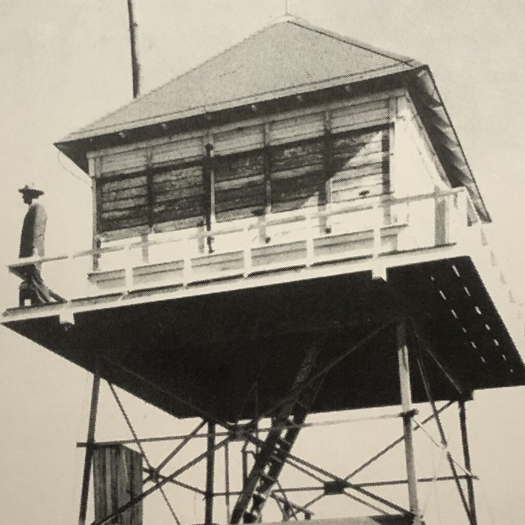
Sunset Peak Lookout Agency: Angeles National ForestDates: 1927-1975Tower: Prototype K-brace tower in which top section is of X-brace design, 20′ tallCab: USFS
San Jose Lookout Agency: LA County Forestry Department (Now LA County Fire Department)Dates: 1925-1950sTower: S40’Cab: N/AStatus: DemolishedElevation: 1250 ftCoordinates: 34.0977, -117.7944References: Ride the Devil Wind: A History of
Sutton Canyon Sutton Canyon (East Fork Pickens Canyon), is an eastern tributary of Pickens Canyon. It descends the southern slopes
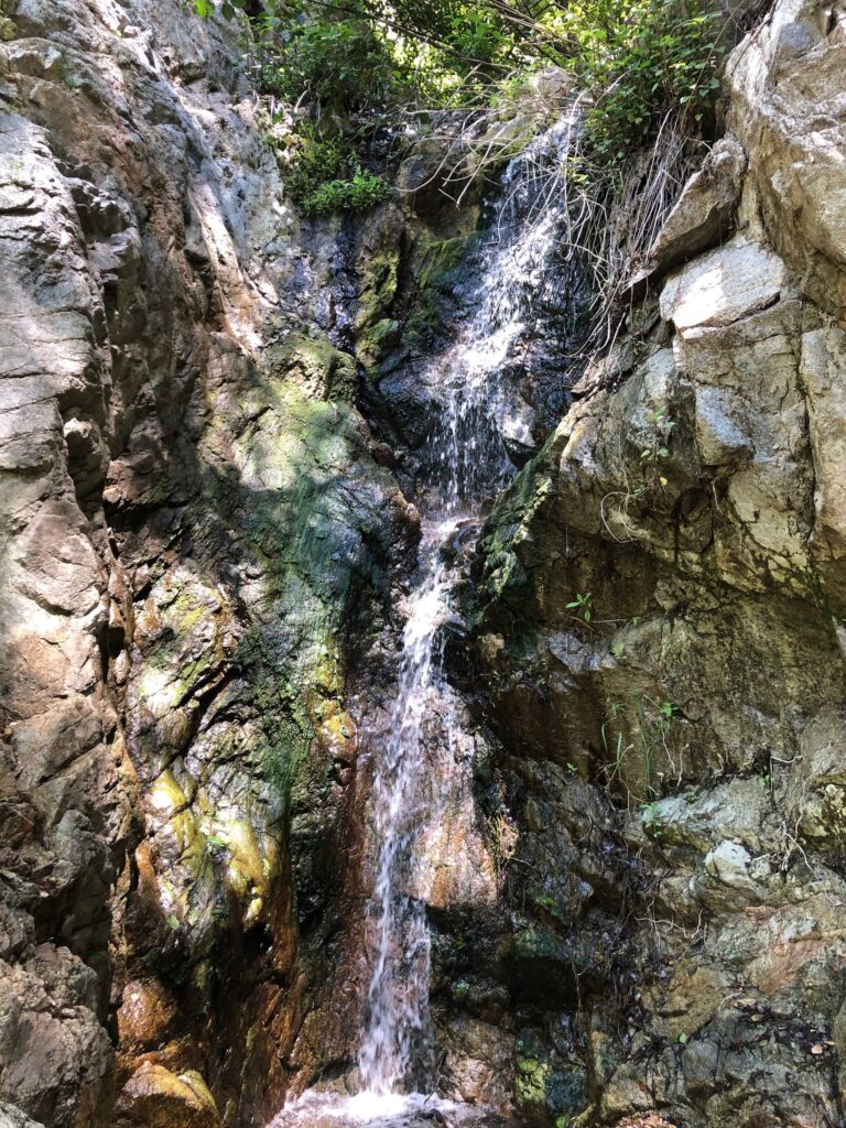
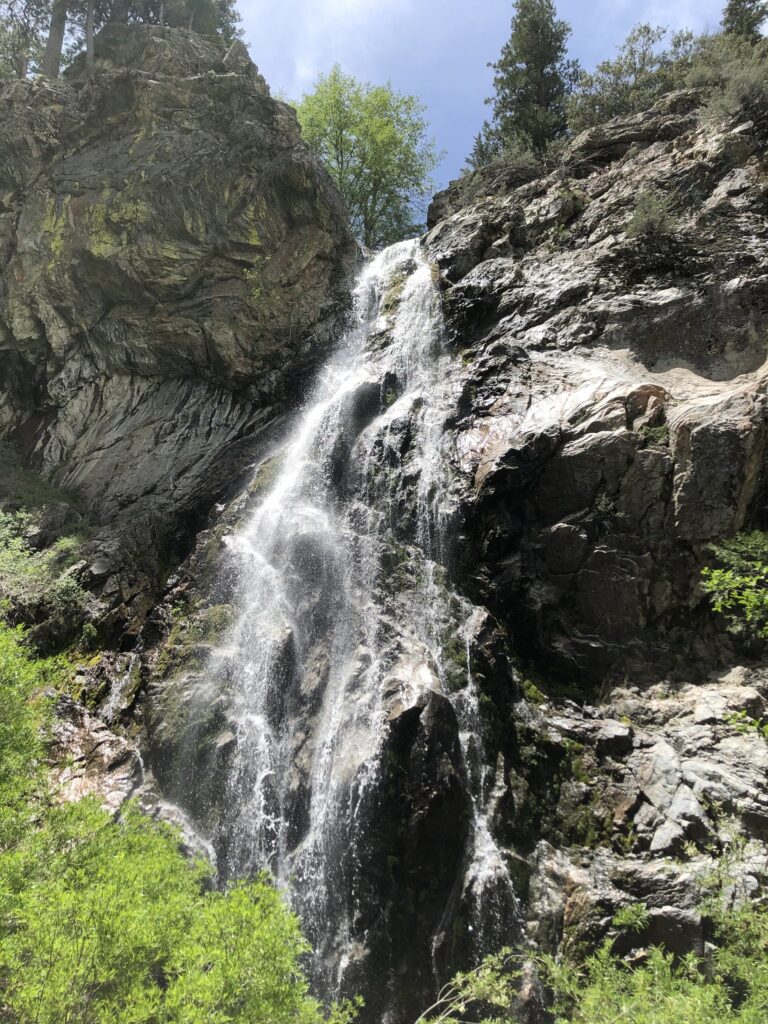
Lower Fox Falls Fox Creek, with its headwaters at the base of Mount Gleason, flows south and east to enter
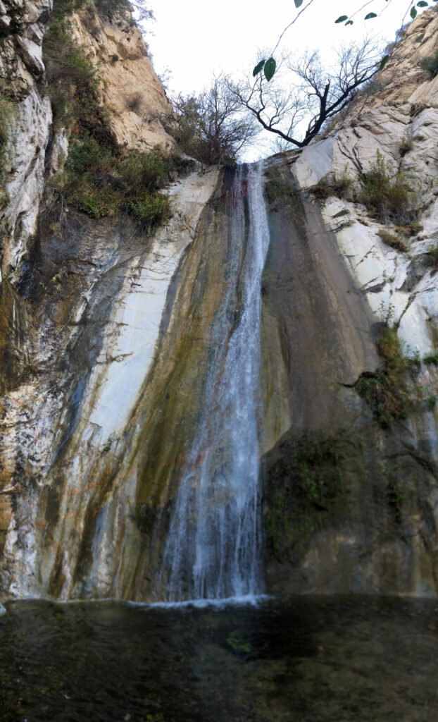
Lower Buckhorn Falls Lower Buckhorn Falls is an impressive yet elusive waterfall in the high country of the San Gabriels.

Tribute to Twinkie Today marks the anniversary of the day when I lost a piece of my heart. It has been
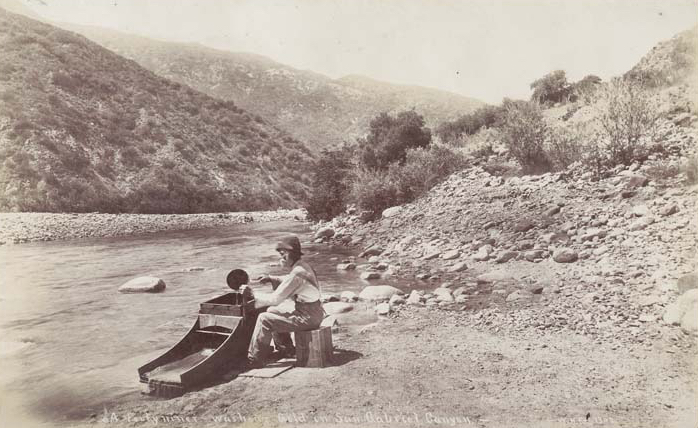
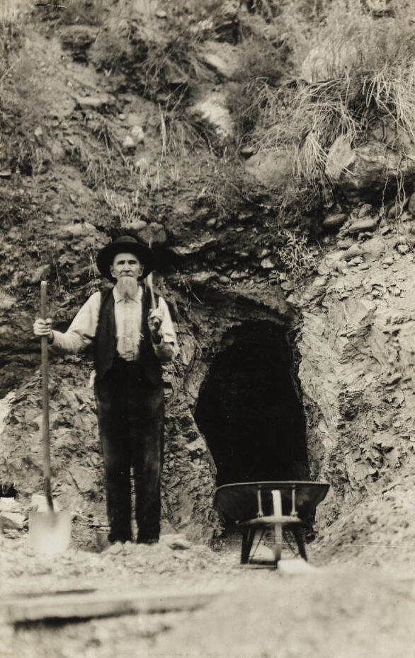
East Fork Part iII Like other Wild West towns, the upper San Gabriel Canyon once teemed with colorful characters who
San Dimas/Johnstone Peak Lookout Agency: Angeles National ForestDates: 1917-1919 Unknown structure-1923-1930s: A short non-battered, open timber tower on a DuBois
East Fork Part iI Although the boom days on the East Fork were over with the demise of Eldoradoville, mining