

Mount Gleason Lookout
Agency: Co-opt with Los Angeles County Forestry Department (Now LA County Fire Department) and Angeles National Forest
Dates: 1926-1940s
Tower: Non-battered, open galvanized steel angle iron X-brace tower, 60 ft tall
Cab: Metal 8′ X 8′ cab
House: Stone
Status: Demolished
Elevation: 6520 ft
Coordinates: 34.37535, -118.17556
References: Ron Kemnow’s California Lookouts & Hundred Peaks Section
 Early activity on Mount Gleason circa 1899
The long, forested shoulder of Mount Gleason lies in the western high country of the San Gabriel Mountains. The summit commands a magnificent panorama of the Antelope Valley and the Mojave Desert. From here, the Mt. Gleason lookout tower once guarded the area against forest fires with its tall steel tower and little stone cabin under the shoulder of the hill.
Mount Gleason was named by Army surveyors in 1875 for George Gleason, a mine superintendent and the first postmaster of Ravenna (an 1860s mining camp in Soledad Canyon). Seeking timber to shore up his mine, Gleason built the first rough road up the slopes of the mountain that now bears his name and discovered gold high on the slope (1869).
 “One of the eyes of the Forest Service.” Credit: USC
Construction of Tower
The LA County Forestry Department began mapping out the Mt. Gleason area in 1925 in order to start preparatory groundwork for a new lookout tower. “A work camp was established at Little Gleason and work commenced on the tower. Water, cement, steel, gravel, sand, lumber, food and supplies were hauled to the end of the road at Gleason Saddle where it was loaded on mules and packed to the tower site. ” –Historic Mount Gleason by Paul H. Rippens. The lookout tower was completed on September 25 and dedicated on September 29, 1926. The tower was 68′ 4″ overall and cost $2,046.22
 Mt. Gleason Lookout dedication, 1926.
 Dedication of Mt Gleason Lookout Tower, 1926. USFS Photo
The lookout cabin was built near the tower and was large enough to accommodate the observer and his entire his family. It was made of natural rock and cost an additional $475.00.
The Mt. Gleason lookout became the first co-op tower between the Los Angeles County Forestry Department and the Angeles National Forest Service. The County built the lookout and would maintain the tower structure while the forest service would furnish the observers and manage the general operations of the tower.
From 1926 to the 1940s the Mount Gleason lookout tower aided in fire protection to the surrounding forest lands and the county. Its views extended as far away as 100 miles, spotting fires in Bakersfield and near the Sequoia National Forest.
Lookouts: I.W. Elliot (1927-1932), Paul Grey (1929), Harold Bunduck (1929), John Clark (1929), Jess Sevier (1935-1936), Earl Moravee (1937), and Charles “Chuck Callin (1940) who got married at the tower because he hadn’t yet qualified for leave of absence.
 Mt. Gleason lookout cabin was made from natural rock. Credit: John Robinson
 Cabin ruin near summit of Mount Gleason, May 1983. Credit: Sierra Club Angeles Chapter Archives
 A father and his two sons manned the lookout in 1931. John Robinson Collection.
 Interior of Mt. Gleason tower with observer at work, 1932. National Archives
Lookout Misadventures
In 1929, Harold Bunduck, Mt. Gleason forest lookout, fell from his tower and injured his leg. He had to wait until a crew could be sent for him. Rangers carried him down the mile-and-a-half trail to the end of an auto road.
In 1932, I.W. Elliott, forestry lookout on Mt. Gleason, was stunned and almost knocked from a fifty-foot ladder he was climbing to a steel lookout tower, when a lightning bolt struck and shattered a tree a few feet from the tower.
In 1937, Earl Moravee, lookout the time, was bitten on the hand by a rattlesnake that crawled Into the cabin at the base of the lookout tower. Moravee cut the wound so it would bleed freely and later applied a tourniquet. He then telephoned the Arroyo Seen ranger station and a rescue party removed him to the Lancaster hospital.
Lookout Demise
The tower served until the late 1940’s. The USFS suffered continual federal budget cuts, and the ever increasing smog reduced the tower’s usefulness. It was dismantled in 1955 to make room for the radar equipment serving a Cold War-era Nike missile base (LA-04) located on the ridge below it.
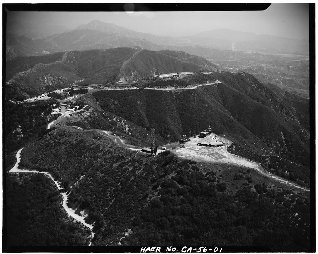
Present Day Mt. Gleason
Access to Mount Gleason is by Forest Service Road 3N17 (Santa Clara Divide Rd), a narrow two-lane winding paved road from Angeles Forest Highway. At about 6 miles, is the LA-04 Nike missile site/former fire Camp 16. The summit of Mt. Gleason (where the former fire lookout and Nike Radar Control was located) is another 1.5 miles directly west of Camp 16.
The Mt. Gleason Road 3N17 was closed to vehicular traffic for more than a decade after the 2009 Station Fire to allow for post-fire forest recovery and demolition of any remaining fire hazard structures. In 2021 it was reopened to motorized traffic, subject to fire conditions. It’s unclear if it stays open all year round.
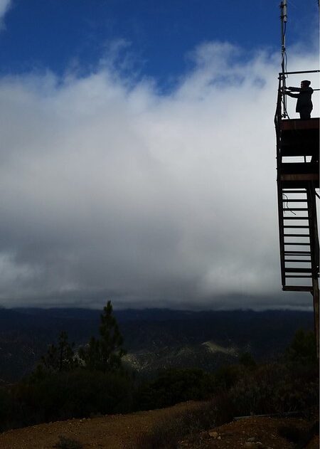
The summit is a a long ridge dotted with pines. There are no remains of the lookout tower or Nike missile radar towers. An EarthScope GPS monitoring station which collects data on earthquakes is presently located on the summit.
 On the way to Mt. Gleason’s summit, former radar area with storage buildings and tanks
 Views from Mt. Gleason. Gently rolling slopes of pines in the backcountry.
 View from Mt. Gleason, Los Angeles lighting up at sunset
 Baby Buttercup at Mt. Gleason summit with EarthScope in background
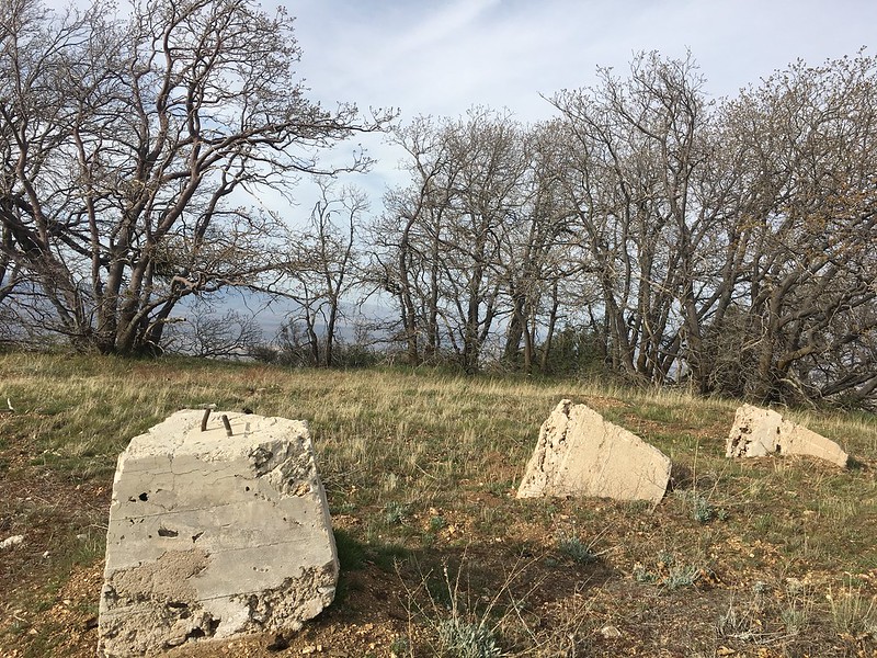
 Cabin lookout remains, its walls still standing 2021
Check out the full album on Flickr: ![]()